

أحدث اصدار
إصدار
1.0
1.0
تاريخ الاصدار
أغسطس 10, 2023
أغسطس 10, 2023
مطور
OsmAnd
OsmAnd
فئات
Travel & Local
Travel & Local
المنصات
Android
Android
التحميلات
0
0
السعر
١٨٫٩٩ ر.س.
١٨٫٩٩ ر.س.
الإبلاغ عن مشكلة
الإبلاغ عن مشكلة
الإبلاغ عن مشكلة
المزيد عن Contour lines plugin — OsmAndlication
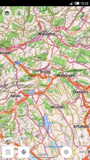
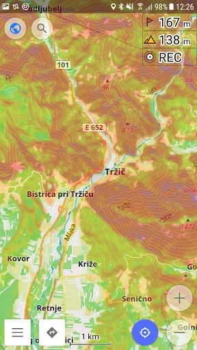
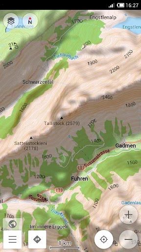
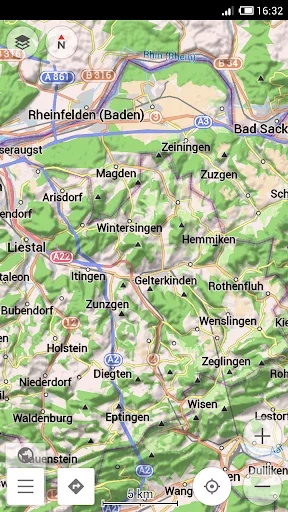
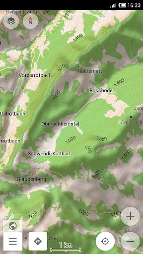
Contour lines plugin — OsmAnd is a plugin for 'Maps & Navigation — OsmAnd' app. The plugin provides extremely detailed offline topo maps that can be zoomed in and out without losing the quality. These topographic maps can also be complemented with a layer of 3D terrain representation ('hillshade'). Contour lines plugin — OsmAnd is a useful reference tool for hikers, tourists, cyclists, and any topography enthusiast.
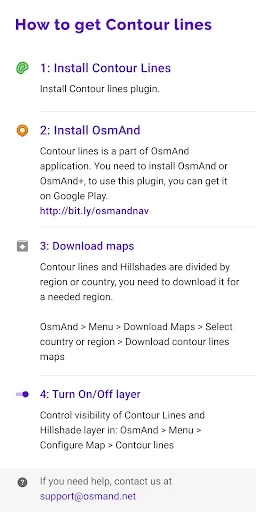
To download the contour lines and hillshade maps, please go to OsmAnd > Download maps > choose the country you need > Contour Lines/Hillshade.
You can enable this layer of information by activating the plugin in OsmAnd > 'Plugins' and also enabling OsmAnd > Configure map > Contour Lines/Hillshade layer.
The global data (between 70 degrees north and 70 degrees south) is based on measurements by SRTM (Shuttle Radar Topography Mission) and ASTER (Advanced Spaceborne Thermal Emission and Reflection Radiometer), an imaging instrument onboard Terra, the flagship satellite of NASA's Earth Observing System. ASTER is a cooperative effort between NASA, Japan's Ministry of Economy, Trade and Industry (METI), and Japan Space Systems (J-spacesystems).
You can enable this layer of information by activating the plugin in OsmAnd > 'Plugins' and also enabling OsmAnd > Configure map > Contour Lines/Hillshade layer.
The global data (between 70 degrees north and 70 degrees south) is based on measurements by SRTM (Shuttle Radar Topography Mission) and ASTER (Advanced Spaceborne Thermal Emission and Reflection Radiometer), an imaging instrument onboard Terra, the flagship satellite of NASA's Earth Observing System. ASTER is a cooperative effort between NASA, Japan's Ministry of Economy, Trade and Industry (METI), and Japan Space Systems (J-spacesystems).
قيم التطبيق
أضف تعليقًا ومراجعة
مراجعات المستخدمين
Based on 0 reviews
لم تتم إضافة أي تعليقات حتى الآن.
لن تتم الموافقة على نشر التعليقات إذا كانت رسائل غير مرغوب فيها أو مسيئة أو خارج الموضوع أو تستخدم لغة بذيئة أو تحتوي على هجوم شخصي أو تروج للكراهية من أي نوع.
المزيد »

تطبيقات رائجة

مترجم كل اللغات - مترجم صوتيOffice Tools- PDF Document Reader_Music Player MP3

Twitter - التويترX Corp.

واتساب مسنجرWhatsApp LLC
Emojikey: ايموجي كيبورد ,GIFPhoto - Picture keyboard

Google ChromeGoogle LLC
Tevegram: Telegram for TVnot.a.bug

MessengerMeta Platforms, Inc.

TelegramTelegram FZ-LLC

Stars Messenger Kids Safe ChatConnect Works

Threads, an Instagram appInstagram